The original dataset from 2011 featured 4557 relevant persons (Bührers, spouses and their children/grandchildren). Up to 2017 the dataset had grown up to 9223 relevant persons, i.e. neatly doubled! This provided ample reasons to redo – with a couple of substantial improvements – the original mapping exercise.
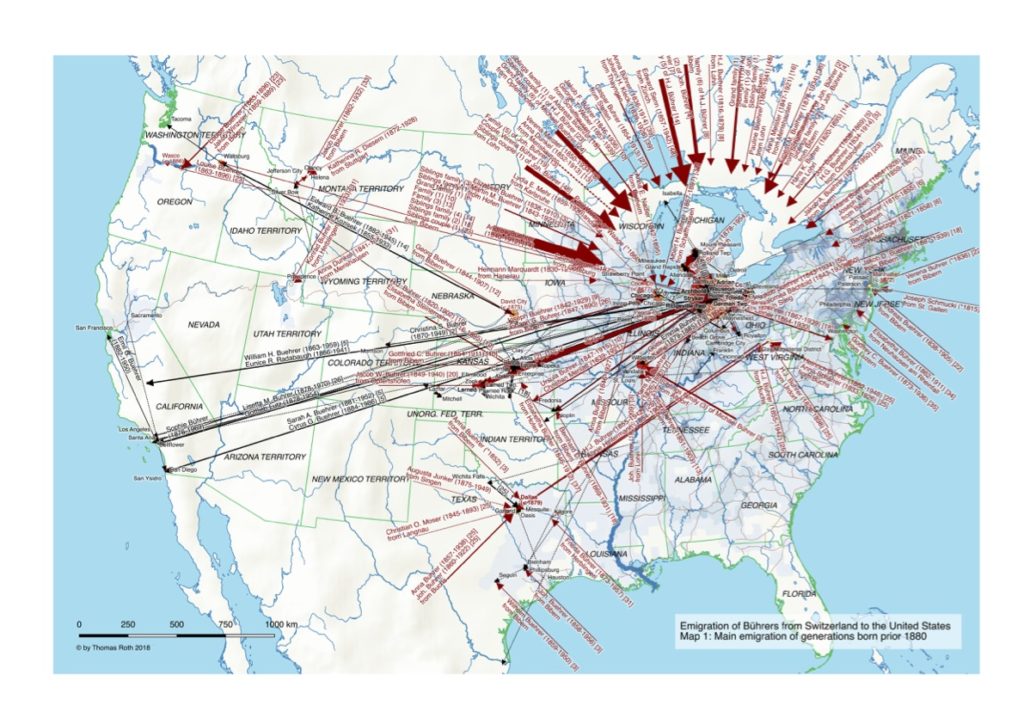
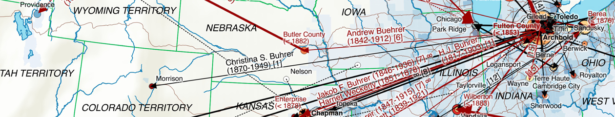
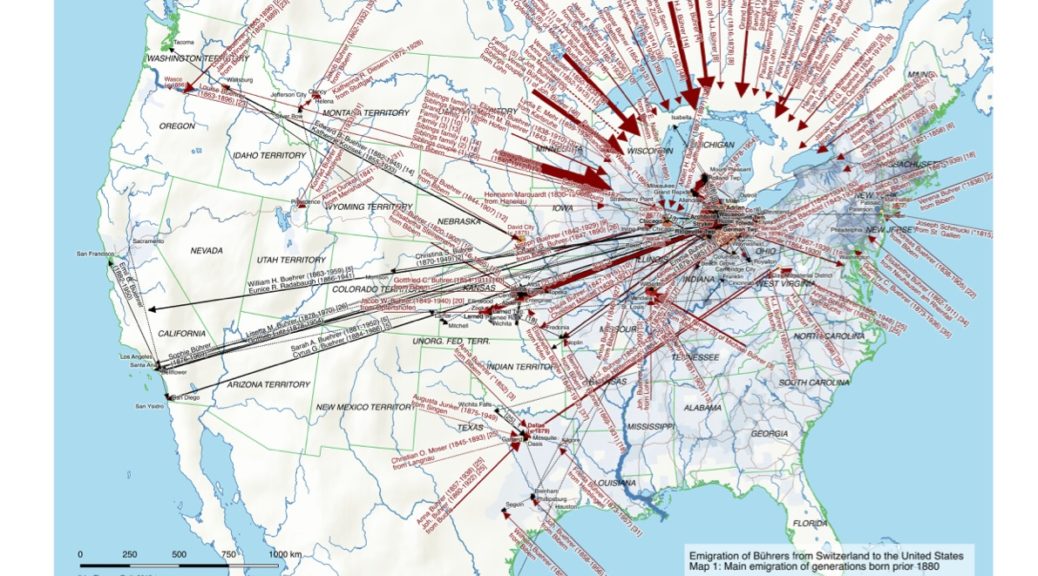
The maps shows – as the earlier ones – the Bührers’ emigration to the United States (Map 1) up to the 1880s and subsequent internal migration up to now (Map 2).

A legend explains the symbology and the groups of emigrated Bührers with common ancestors. In contrast to the earlier maps there has been no manual tweaking, with exception of the orientation of the immigration arrows. The big challenge is clearly visible in Map 2: the larger number of persons means there’s really too much going on to fit it on one map!
The major changes compared to the earlier version in 2015 are:
- Emigrated Bührers where matched against emigration/immigration evidence, e.g. passport lists, ships lists at port of embarkation, US immigration records and US census information. This allowed (see 2nd page of legend for emigrated groups of Swiss Bührers) to more accurately determine/narrow down the actual time of emigration.
- Normalization, completion and geocoding of places was done using a person’s context (e.g. where other relatives had lived/died) to geocode places that otherwise would not be clearly identifiable (e.g. “West Rome Cemetery”). This allowed to geocode substantially more places and hence produces more migrations.
- Determination of a common male ancestor was combined with deriving the family status for emigrants in a more robust procedure that can accurately handle also more complex cases such as three generations of emigrated Bührers with intermarriage with other emigrated Bührers. As a result some of the groups of emigrated Bührers have changed.
- Assignment of persons to a time period (generations prior/beyond 1880) was reworked. This allows a flexible ad-hoc definition of periods based on the common minimal birth year of a group of siblings and their spouses. Furthermore extrapolation to ancestors/descendants via a generation offset (25 years) allows the period estimation of persons with no known birth year.
In terms of map-making the are few notable optimizations:
- The number of distinct Bührer persons per county and common ancestry is indicated with pie charts, allowing to visualize both the total number of Bührers and the repartition by ancestry. QGIS 2.18 strictly speaking still doesn’t support this feature (treating diagrams as labels that float on top), but using a workaround with two map layers in the composer (one below with the base map including the pie chart diagrams and remaining places, the other above with the migration arrows and all the labels) did the trick.
- Descendants are no longer shown (i.e. their immigration, migration as well as number of persons per county) because they are irrelevant/arbitrary in the US emigration context.
- Meaningful migration labels are now fully computed, even though a few could still profit from manual tweaking. A custom label ranking for migration paths was developed to prevent label cluttering and lets the important labels prevail (e.g. those with first migration evidence). Place labels were optimized to only show first migration evidence (in red) if this occurred in the respective period.